The project Robotic Landscaping aims to develop computational tools, technologies and workflows for automated and digitally controlled landscaping, reaching a precision on complex shapes that could not be achieved through manual excavation methods. The process also utilizes a HEAP robotic excavator, equipped with a bucket, to bring the plans of the landscape architect to reality.
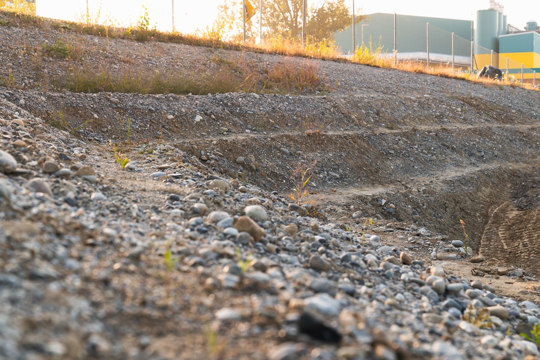
The robotic landscape in this park serves the purpose of connecting the high elevation difference from the bottom side of the wall with the top side. Four large embankments are realized with smaller steps on them. The steps are built with a high accuracy by the robotics system in order to prevent water runoff in undesired directions and thus hinders erosion without having to place a natural fabric over the bare grounds as is common in conventional methods. These steps provide an ideal habitat for small animals and plants.
The machine utilizes GNSS and the LiDAR sensors installed on the roof to create a three dimensional map of the environment. This map is constantly updated while the machine is excavating and is used to compare the current state of the excavation site with the plan created by an architect in order to subsequently infer where to dig next. It will then repeat this process over and over.
The main challenge in autonomous excavation is the unknown soil, given by the fact that it can be unpredictably hard and withstonesorsoft. An expert operator has learned over many years how to adapt the motions to address this, and similarly the autonomous machine needs to be able to sense and adapt to different soil types, taking into account pressure measurements in the hydraulic cylinders.
This research demonstrates a powerful computational landform editing tool using 2D distance functions for manipulating digital elevation data to construct valid terrain designs for robotic constructions. The modelling of a digital terrain model can be achieved by direct construction from the measured data into a grid-based data set. Topographic design adjustments can then be encoded parametrically through applied function representations to the terrain data, allowing for multiple boolean, or “cut and fill” operations on an existing terrain. The result is a highly flexible design tool that enables many adjustments to fluctuating on site conditions.
The entire landscaping process is digital and allows the precise planning and allocation of the available resources. First, a detailed view of the construction site is collected with a drone; in a further step, the landscape architect uses this data to design a plan which is material neutral. This means that it is possible to measure the exact amount of earth needed and to know ahead of time where it will be placed within the park. In this way no transport of additional material from or to the construction site is needed.